.png)
The RAFT implementation year on the Northern Neck ran from August 2020- July 2021. On August 18, 2021, the Northern Neck localities came together in a virtual workshop to share outcomes, lessons learned, and plans for the future. The workshop was recorded, and the following products are available for reference:
- Full Workshop Video (youtube playlist)
- Meeting Summary (.pdf)
- Resources Document (.pdf)
- Presentation Slides (.pdf)
2019-2020 Northern Neck
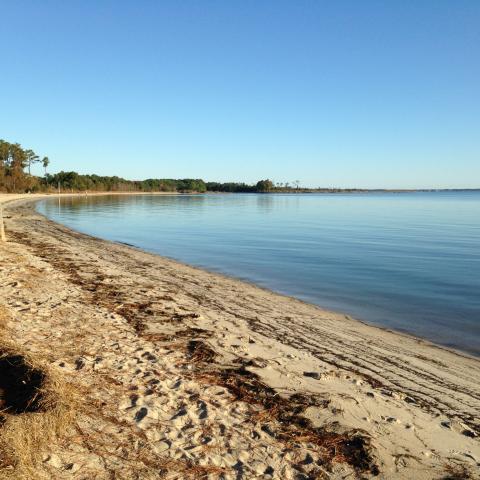
Northumberland County
Northumberland County is a community located in the Northern Neck region of Virginia. Northumberland County is located between the Rappahannock and Potomac Rivers. The town is 192 square miles.
According to the 2017 American Communities Survey 5-Year Estimates, Northumberland County has a population of 12,254. The median age in the county is 56.5, which is 18.5 years higher than the national median age.
The shores of Northumberland County extend 509 miles. Of this shoreline, 48.1% is dedicated to residential use. The most serious erosion threats for the County come from northeasters and hurricanes, which primarily affect the Potomac River bank and the Chesapeake Bay bank. Furthermore, there is significant development within the County’s 100-year floodplain. Northumberland County has chosen to address this flooding issue by: (1) promoting citizen awareness of the dangers of developing in a flood zone, (2) establishing performance guidelines for new development within identified floodplains, (3) restricting wastewater disposal and utilities in or adjacent to frequently flooded areas, (4) continuing to enforce County ordinances related to Floodplain Management, Erosion and Sediment Control, and Subdivisions, and (5) restricting wastewater disposal systems and utilities in or adjacent to areas suffering from frequent flooding.
Northumberland County participated in creating the 2017 Northern Neck Hazard Mitigation Plan. Further, the Northern Neck Planning District Commission also assists the County with the FEMA application process for properties that qualify for home elevation grants.
Photo courtesy of Northern Neck Tourism
Scorecard, Opportunity List, and Resilience Action Checklist:
Northumberland County's Scorecard
Northumberland County's Opportunity List
Northumberland County's Resilience Action Checklist
Maps:
Northumberland County Sea Level Rise (SLR) Map
Northumberland County SLR Satellite Map
Warsaw
The Town of Warsaw is located approximately five miles north of the Rappahannock River. The Town is generally in the center of Richmond County and is located on the Northern Neck plateau at the intersection of U.S. Route 360 and State Highway 3.
The Town is approximately 2.96 square miles in size. According to the 2017 American Communities Survey 5-Year Estimates, the Town has a population of 1,640. The median age is 43.7 years, which is 5.7 years higher than the national median age.
According to the Town’s 2018 Comprehensive Plan, shoreline and streambank erosion control is identified as a top priority, with the most conspicuous illustration of this threat being its Jug’s Creek watershed, also known as “the Bottom.” This watershed is prone to flooding during heavy rain seasons as the stormwater infrastructure is overwhelmed, too. To address these issues, the Town utilized the Low Impact Development planning tool, that maintains and enhances the predevelopment stormwater runoff and water flow characteristics of urban and/or developed watersheds.
Photo by Chesapeake Bay Program via Flickr
Scorecard, Opportunity List, and Resilience Action Checklist:
Warsaw's Resilience Action Checklist
Maps:
Richmond County Storm Surge Map (showing Warsaw)
Richmond County Storm Surge Map (plus 1.5 ft SLR) (showing Warsaw)
Other Resources:
Redesign of Warsaw Stormwater Park - Student work from Professor Karen Firehock's Green Infrastructures class at the University of Virginia
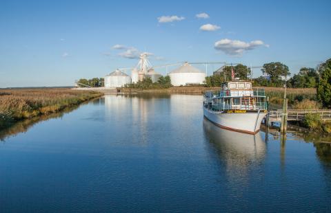
Richmond County
Richmond County is a community located in the Northern Neck region of Virginia. Richmond County is located near the Rappahannock River. The town is 203 square miles (129,920 acres), of which approximately 11 square miles are water
According to the 2017 American Communities Survey 5-Year Estimates, Richmond County has a population of 8,873. The median age in the county is 44.0, which is 6 years higher than the national median age.
Richmond County has 197 miles of shoreline. While most of Richmond County is not affected by flood prone areas, the most vulnerable areas are also the most desirable areas for development. The County’s Comprehensive Plan recommends that planning objectives for these areas should focus on avoiding the construction of permanent facilities in these locations. The Comprehensive Plan also advises against living or working in these areas.
Richmond County participated in creating the 2017 Northern Neck Hazard Mitigation Plan. Further, the Northern Neck Planning District Commission also assists the County with the FEMA application process for properties that qualify for home elevation grants.
Photo provided courtesy of Northern Neck Tourism
Scorecard, Opportunity List, and Resilience Action Checklist:
Richmond County's Opportunity List
Richmond County's Resilience Action Checklist
Maps:
Richmond County Sea Level Rise (SLR) Parcel Map
Richmond County SLR Satellite Map

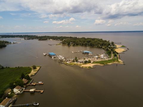
White Stone
The Town of White Stone is located in Lancaster County and is approximately 0.98 square miles. The Town is approximately 125 miles to the southeast of Washington, D.C.
According to the 2017 American Communities Survey 5-Year Estimates, the Town of White Stone has a population of 409. The median age is 50.8 years, which is 12.8 years higher than the national median age.
Photo taken by Scott Adams, provided courtesy of Northern Neck Tourism
Scorecard, Opportunity List, and Resilience Action Checklist:
White Stone's Opportunity List
White Stone's Resilience Action Checklist
Maps:
White Stone Sea Level Rise (SLR) Parcel Map
White Stone Storm Surge Map (plus 1.5 ft SLR)
Other Resources:
Pocket Park Design from Karen Firehock's Green Infrastructures Class at the University of Virginia
Incentivized Resiliency Options (Green Infrastructure)
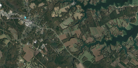
Kilmarnock
The Town of Kilmarnock is a community located in Lancaster and Northumberland counties, Virginia. Kilmarnock is located near the Rappahannock River. The Town is 2.9 square miles. Out of this area, 0.35% is water.
According to the 2017 American Communities Survey 5-Year Estimates, Kilmarnock has a population of 1,493. The median age in the county is 54.1, which is 16.1 years higher than the national median age.
To address flooding, Kilmarnock passed a Floodplain Overlay District Ordinance. The Town requires flood-proofing and elevating structures with that district. Further, the Town also identifies highly erodible soils in its Comprehensive Plan. This Plan requires the following policies to address erosion: (1) identification and monitoring of areas where erosion is a critical issue, and delineation of a drainage area for stormwater runoff in these areas; (2) identification of funding opportunities to implement stream bank restoration projects; and (3) enforcement of the Erosion and Sediment Control Law requirements to minimize sedimentation and erosion within the watersheds located in Kilmarnock.
Kilmarnock participated in creating the 2017 Northern Neck Hazard Mitigation Plan. Thirteen percent of Kilmarnock’s land is undevelopable because of Resource Protection Areas and conservation easements. The Town’s Comprehensive Plan provides several policies related to erosion including increasing plant-based riparian buffers, discouraging development on highly erodible soils, clustering development, and adding more conservation easements.
Photo courtesy of Google Maps/Google Earth
Scorecard, Opportunity List, and Resilience Action Checklist:
Kilmarnock's Resilience Action Checklist
Maps:
Kilmarnock Sea Level Rise (SLR) Parcel Map
Kilmarnock Storm Surge Map (plus 1.5 ft SLR)
Other Resources:
Strategies for Conserving the Green Infrastructure of Kilmarnock, VA - presentation and report

Lancaster County
Lancaster County is a community located in the Northern Neck region of Virginia. Lancaster County is located near the Rappahannock River. The county is 135 square miles.
According to the 2017 American Communities Survey 5-Year Estimates, Lancaster County has a population of 10,848. The median age in the county is 56.3, which is 18.3 years higher than the national median age.
Lancaster County has approximately 330 miles of tidal shoreline. The Lancaster County Comprehensive plan includes three goals related to shoreline protection: (1) Actively encourage shoreline protection measures that are equal to the erosion potential at a particular site; (2) Encourage vegetative enhancement of Resource Protection Area (RPA) sections; and (3) Encourage coordinated shoreline protection efforts in existing waterfront communities and in new subdivisions.
Lancaster County participated in creating the 2017 Northern Neck Hazard Mitigation Plan. Further, the Northern Neck Planning District Commission also assists the County with the FEMA application process for properties that qualify for home elevation grants. Additionally, the County has allowed for a living shoreline to be installed along Hill’s Creek. The County’s Comprehensive Plan encourages setting aside open space for conservation purposes. The County Comprehensive Plan encourages vegetative alternatives for shoreline protection and supports programs for educating waterfront property owners about shoreline protection.
Photo courtesy of Northern Neck Tourism
Scorecard, Opportunity List, and Resilience Action Checklist:
Lancaster County's Opportunity List
Lancaster County's Resilience Action Checklist
Maps:
Lancaster County Sea Level Rise (SLR) Parcel Map
Lancaster County SLR Satellite Map
Colonial Beach
The Town of Colonial Beach is a beach community located in Westmoreland County, Virginia. Colonial Beach abuts the Potomac River, 65 miles from Washington, D.C. The Town is approximately 2.3 square miles (1,473 acres). Open water surrounds the town on three sides.
According to the 2017 American Communities Survey 5-Year Estimates, Colonial Beach has a population of 3,541. The median age in the county is 50.2, which is 12.2 years higher than the national median age.
Erosion is a major problem for Colonial Beach, affecting roadways and parklands. The Town’s Comprehensive Plan specifically identifies property along the Potomac River, Beach Avenue, and the shoreline of Monroe Bay from the 600 block south to Colonial Beach Yacht Center as requiring immediate attention. To address these issues, the Town has adopted Policy Recommendations in its Comprehensive Plan including: (1) establishing a strategic plan to prioritize problem areas and implement erosion control devices; (2) informing private waterfront owners of the free technical assistance available to them concerning shoreline erosion control devices; and (3) encouraging Town officials and private landowners to take a more active role in the public hearing process of the Westmoreland County Wetlands Board.
Colonial Beach participated in creating the 2017 Northern Neck Hazard Mitigation Plan. The Town has also allowed a living shoreline to be created in Robin Grove Park as a shoreline management measure. Further, the Town also has created a conservation district which includes setting aside open space.
Photo by Tom Saunders via Flickr
Scorecard, Opportunity List, and Resilience Action Checklist:
Colonial Beach's Opportunity List
Colonial Beach's Resilience Action Checklist
Maps:
Colonial Beach Sea Level Rise (SLR) Parcel Map
Colonial Beach SLR Satellite Map
Colonial Beach Storm Surge Map
Colonial Beach Storm Surge Map (plus 1.5 ft SLR)
Other Resources:
A Framework for Coastal Flood Planning: Colonial Beach, VA
Strategies for Conserving the Green Infrastructure of Colonial Beach, VA
Recommendations for Incorporating Resilience into the Comprehensive Plan of Colonial Beach, VA
Shoreline Change Analysis of an Estuarine Recreational Beach, Town of Colonial Beach, Virginia
Student proposals from Green Infrastructures with Professor Karen Firehock at the University of Virginia:

Town of Montross
The Town of Montross is located in the south-central portion of Westmoreland County. Route 3, the primary highway, runs through the center of Town and serves as its main street. The Town is approximately 90 miles to the northeast of Virginia’s capital, the City of Richmond.
According to the 2017 American Communities Survey 5-Year Estimates, the Town of Montross has a population of 356. The median age is 57.4 years, which is 19.4 years higher than the national median age.
Because the soil in the area is highly erodible and frequently saturated, the Town has placed a priority on ensuring that sensitive environmental areas remain undisturbed and that the vegetation is also protected. This is critical to maintaining both adequate stormwater management and erosion and sedimentation control from existing shorelines and streambanks.
In addition, the Town of Montross is home to a Superfund site, which is currently contained and does not pose a threat to the Town’s drinking water supply. This is largely due to the soil’s predominantly clay-like characteristic.
Please note: The Town of Montross will not be receive its own resilience assessment and scorecard, but will be incorporated into The RAFT process as part of Westmoreland County.
Photo courtesy of maj22443 via Flickr

Irvington
The Town of Irvington is located in Lancaster County and is approximately 125 miles southeast of Washington, D.C. At one point, the Town was regarded as the largest town in the County and the center of the County’s seafood business. The Town is approximately 1.83 square miles in size and has been designated as an historic district.
According to the 2017 American Communities Survey 5-Year Estimates, the Town has a population of 345. The median age is 66.1 years, which is 28.1 years higher than the national median age.
Please note: The Town of Irvington will not be receive its own resilience assessment and scorecard, but will be incorporated into The RAFT process as part of Lancaster County.
Photo courtesy of Trader Doc Hogan via Flickr

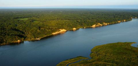
Westmoreland County
Westmoreland County is located on the Northern Neck Peninsula in eastern Virginia and covers an area consisting of 236 square miles bounded on the north by the Potomac River and on the south by the Rappahannock River. Because the County borders along two rivers, there are 252 miles of shorelines in the county. Westmoreland County is about 78 miles to the southeast of Washington, D.C. and 65 miles to the northeast of Virginia’s capital, the City of Richmond.
According to the 2017 American Communities Survey 5-Year Estimates, Westmoreland County has a population of 17,596. The median age is 47.6 years, which is 9.6 years higher than the national median age.
The majority of the land in the County is currently used for forestry or agriculture. Forestland is the most common land use. Today, there are very few mature, diverse hardwood forests remaining in Westmoreland County. Intensive harvesting is occurring across the region, with retention only required for buffering along streams and wetlands.
According to Westmoreland County’s 2010 Comprehensive Plan, erosion and flooding are identified as the top two threats to County resources. Because of frequent saturation and unusually erodible soil characteristics, erosion occurs more frequently than in any other locality. To address this threat, the County’s Comprehensive Plan called for greater scrutiny on new development and to maintain the existing shoreline profile as much as possible.
Photo courtesy of Northern Neck Tourism
Scorecard, Opportunity List, and Resilience Action Checklist:
Westmoreland County's Scorecard
Westmoreland County's Opportunity List
Westmoreland County's Resilience Action Checklist
Maps:
Westmoreland County Sea Level Rise (SLR) Parcel Map
Westmoreland County SLR Satellite Map