The pilot communities of Cape Charles, Gloucester, and Portsmouth were selected on the basis of several criteria, including a willingness to participate, demographic diversity, diversity in municipality type, density, size, varying stages in comprehensive planning, and physical vulnerability to coastal flooding. They were also selected from three different planning district commissions in Virginia to assess communities in different areas of the coastal region.
Pilot Project Communities
 Cape Charles
Cape Charles
The Town of Cape Charles is located in southern Northampton County on the Chesapeake Bay. The town is surrounded by the Chesapeake Bay, Old Plantation Creek and King’s Creek on three sides and thus forms a small peninsula. The 4.4 square miles of land in town is low lying and relatively flat, with most of the developed land in town only between five and 10 feet above sea level (Virginia Comprehensive Plan).
Cape Charles’ population is 1,009, with a median age of 50.6 which is 12.5 years higher than the national median age.
The primary hazard for Cape Charles has been coastal flooding, storm water flooding, and straight-line winds also are a threat to the Town associated with hurricanes and northeasters. During the past eight years the Town of Cape Charles has had an aggressive plan to mitigate erosion along its entire shoreline and harbor area. The Eastern Shore Hazard Mitigation Plan used a state-of-the-art tool (HAZUS) to estimate damages to Cape Charles due to wind, coastal erosion, coastal flooding and storm water flooding. The worst-case scenario for the Town is a storm that causes storm surge and pushes water into the town.
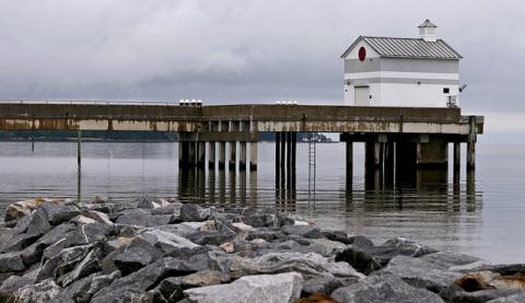
The Town has utilized post-disaster funds to repair the substantially damaged fun pier and to complete a beach re-nourishment. They are also trying to develop and improve public waterfront harbor properties to enhance their recreation and economic potential and to magnify the attraction for the broader public life.
Scorecard and Resilience Action Checklist:
Cape Charles RAFT Workshop Report, including the town's assessment and Resilience Action Checklist.
Maps:
Cape Charles Critical Infrastructure Maps- 2030, 2040, and 2065 Conditions
Cape Charles Opportunities for Mitigating Flooding Map
Other Resources:
Cape Charles Dunes and Beaches: Wetlands and Coastal Dune Board Authority and Guidelines
Cape Charles' Roads Maintenance and Control Memo
Cape Charles' Town Council Work Session Presentation
Flooding in Cape Charles Poster
Methods of Incentivizing Private Action for Resilience
RAFT Info Postcard for Cape Charles
Photo by nrg_crisis via Flickr
 Portsmouth
Portsmouth
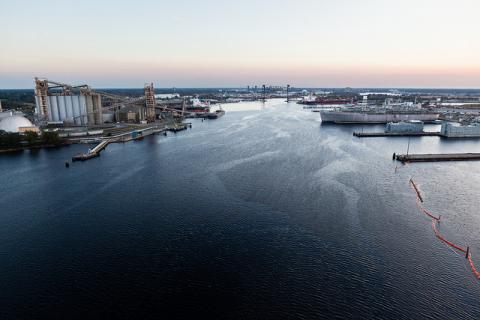
Portsmouth is a city in the state Virginia surrounded by Norfolk and Suffolk on either sides, with a land area of approximately 30 square miles and a population of 100,565 people, is located in the hub of the Hampton Roads Region. It is bordered by the cities of Chesapeake and Suffolk to the south and west respectively, and by the City of Norfolk to the east. The median age of Portsmouth is 40, which is almost four years higher than the national median age.
Many flood events that have occurred in the region have been the result of coastal storms, tornadoes, tropical storms or hurricanes. Other localized flooding occurs when heavy rains fall during high tide causing waters that would normally drain quickly to back up because of the tides. Increased coastal erosion, inundation of normal dry lands, coastal flooding and saltwater intrusion are some of the hazards that normally occur as the sea level rises.
The Town of Portsmouth has established the following mitigation plan goals:
1. Implement hazard mitigation actions in order to protect Portsmouth's residents, and cultural, historic, structural and natural environments.
2. Promote educational opportunities to introduce residents and visitors to the risks of natural hazards and the various appropriate mitigation strategies that can be taken.
3. Continue to reduce flood losses through compliance with National Flood Insurance Program requirement
4. Continue to manage the development in natural environments
5. Continue to manage the development in hazard-prone areas
In 2019, Portsmouth adopted a new comprehensive plan with Resilience as one of their core values.
Scorecard and Resilience Action Checklist:
Portsmouth's RAFT Workshop Report, including the town's assessment and Resilience Action Checklist.
Other Resources:
Incorporating Resilience into Local Ordinances, Portsmouth
Methods of Incentivizing Private Action for Resilience
Photo courtesy of Will Parson/Chesapeake Bay Program
 Gloucester
Gloucester
Located at the east end of the lower part of the Middle Peninsula, Gloucester County is bordered on the south by the York River and the lower Chesapeake Bay on the east, both of which have shaped its development.
The median age of Gloucester is 42, almost four years higher than the national median age. Its total population was 37,292 in 2017.
Coastal flooding often occurs when strong onshore winds and or storms associated with low pressure create a storm surge that can push water from the coastline inland. Slow moving storms or stationary frontal systems also increase the town’s vulnerability to flooding (Gloucester Flood Management).
Gloucester County and its residents are beginning to see the benefits of Hazard Mitigation. Because of its proximity to the mouth of the Chesapeake Bay, the County is subjected to periodic flooding from coastal storms. Flooding is exacerbated in the coastal areas because of the numerous wetlands, streams, and creeks within its borders.
The County has used funds from Hazard Mitigation Grant Programs to purchase and demolish properties that faced significant risk of inundation, as well as to elevate other properties. These steps will help reduce the potential loss of life and property in the affected areas and will also reduce future pollution of the Chesapeake Bay.
Scorecard and Resilience Action Checklist:
Gloucester's RAFT Workshop Report, including the town's assessment and Resilience Action Checklist.
Other Resources:
Options for Properties Subject to Recurrent Flooding and Sea Level Rise
Methods of Incentivizing Private Action for Resilience
Photo courtesy of Aileen Devlin/Virginia Sea Grant

.png)


